GIS for hydrogeology and groundwater
GIS hydrogeology solutions and groundwater management: hydrogeological modeling, aquifer mapping, and water resource management.
Discover our servicesOur Hydrogeology Services
Hydrogeological Mapping
Creation of detailed maps of aquifers and hydrogeological systems for optimal water resource management
Aquifer mapping
Watershed delineation
Capture and protection zones
Piezometric maps
Flow Modeling
Numerical models to simulate groundwater flow and predict groundwater table evolution
2D/3D flow models
Pumping simulation
Drawdown prediction
Model calibration
Water Resource Management
Decision support tools for sustainable exploitation of groundwater resources
Hydrogeological balances
Exploitation scenarios
Extraction optimization
Sustainability assessment
Hydrogeological Monitoring
Real-time monitoring systems for groundwater levels and quality
Monitoring networks
Automatic alerts
Trend analysis
Interactive dashboards
Completed Projects
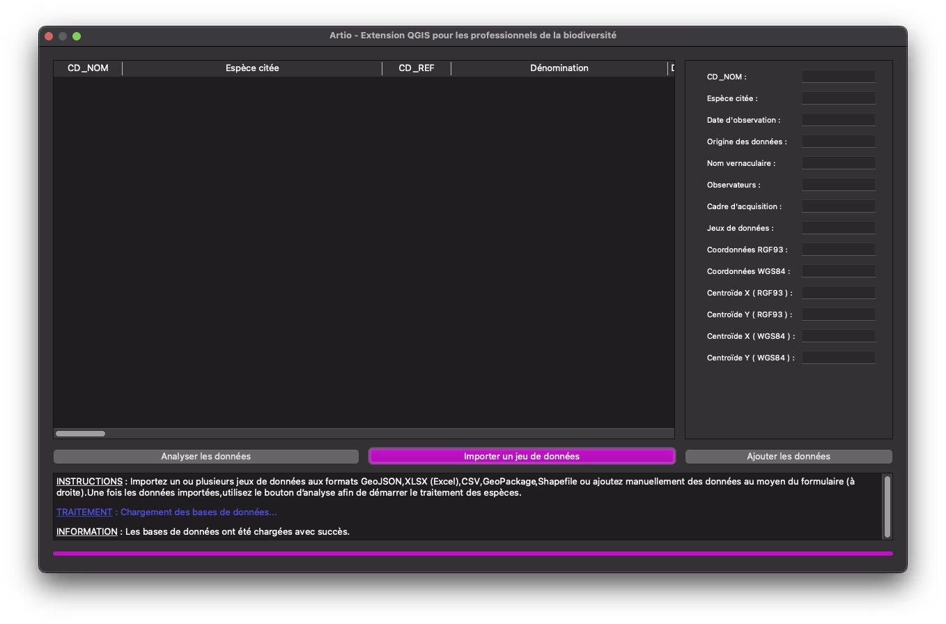
Artio
Generation of summary tables presenting species identified in a study framework with their associated statuses
Species mapping
Biodiversity analysis
Automated reports
Ecological data integration
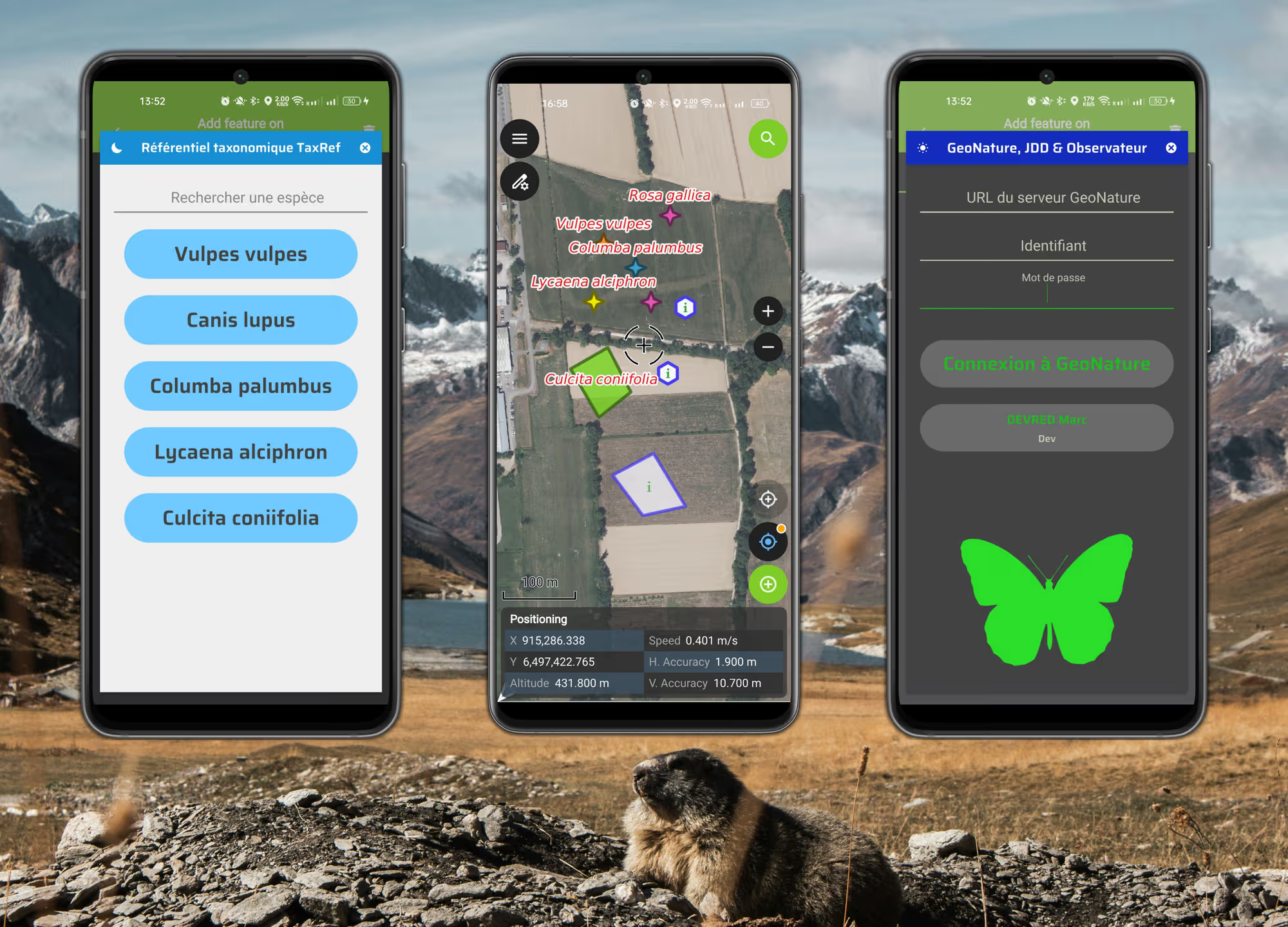
TaxField
Environmental data tracking and management solutions with QField Plugins
Field data collection
Taxon management
Mobile GIS integration
Custom QField plugins
Tools and Technologies
Ready to optimize your water resources?
Contact us to discuss your hydrogeological project and discover how our GIS solutions can help you