Geospatial Data Management & Automation
Transform your geospatial data management with our automated solutions. Optimized collection, storage, and strategic analysis.
Automated ETL
Multi-Source
Real Time
Quality Controlled
Time Saved
Reliability
Monitoring
Sources to handle
Complete Automation Solutions
Our solutions cover the entire geospatial data processing chain, from automated collection to delivery through modern technologies. We design robust architectures that adapt to your technical and organizational constraintsQuality Control
Automatic validation of geometric and attribute consistency with intelligent correction
Anomaly detection
Automatic correction
Critical alerts
Quality reports
Real-time Dashboard
Customized interfaces to visualize and manage your data in real time
Real-time alerts
Advanced filters
Dynamic analysis
Support and Maintenance
Dedicated technical assistance to ensure the performance and reliability of your systems
24/7 support
Regular updates
Continuous training
Quick Information
Average Timeline2-8 weeks
Supported Sources10+ formats
Availability99.9% SLA
Support24/7
Need a consultation?Our experts are available to analyze your specific needs and propose adapted solutionsFree Consultation
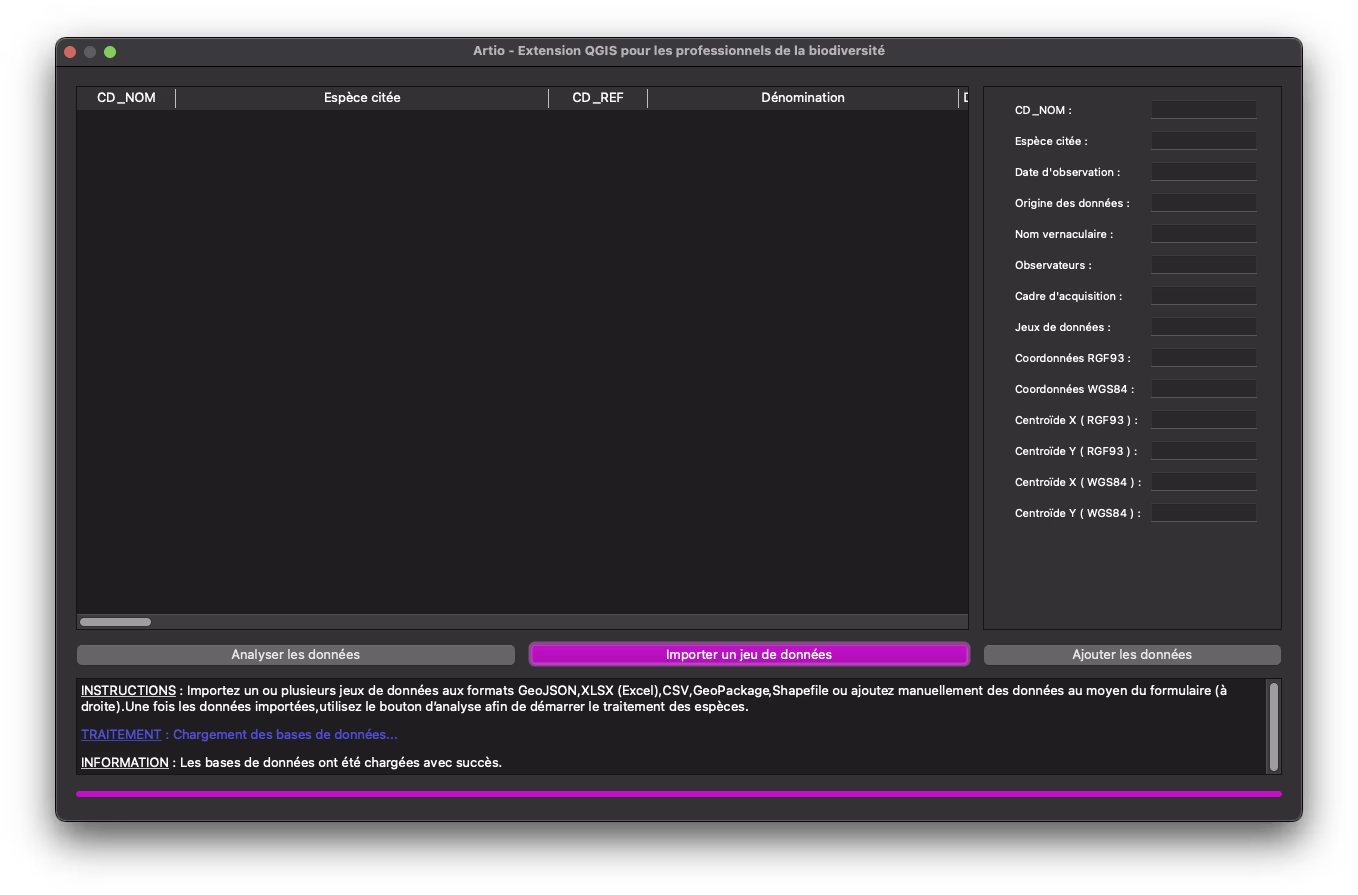
Use Case: Endangered Species Analysis
Complete automation of natural species data management from INPN with 600,000 data points. Integration of more than 10 different data sources with automatic updates and real-time dashboard for data observationData Processed
Sources Integrated
Time Saved
Frequently Asked Questions
What types of data sources can you integrate?
How long does it take to set up automation?
How do you guarantee the quality of automated data?
Is the solution scalable and maintainable?
Ready to Automate Your Geospatial Data?
Let's discuss your project and discover how our solutions can transform your geospatial data management