Artio
Artio, a tool for biodiversity analysis and mapping. A professional GIS solution to study, visualize, and preserve natural ecosystems.
Python
QGIS
PyQt
Client
Environmental consulting firm
Duration
4 months
Category
Environment & GIS
Project Overview
Artio is a comprehensive solution developed to automate the generation of summary tables for environmental studies. This application enables ecologists and researchers to efficiently analyze biodiversity data by creating detailed reports on identified species and their conservation status. With advanced mapping features and ecological data integration, Artio streamlines the visualization, analysis, and standardization of results, while optimizing processing time and study accuracy.
Features
Species mapping
Biodiversity analysis
Automated reports
Integration of ecological data
Technical Challenges
Integration of heterogeneous data
Automation of manual processes
Ensuring compliance with ecological standards
Technologies Used
Python
QGIS
PyQt
PylightXL
XLSXWriter
Results Achieved
99% reduction in data processing time (from over 6 hours to 30 seconds)
Improved analysis accuracy
Standardization of study reports
Visual Overview
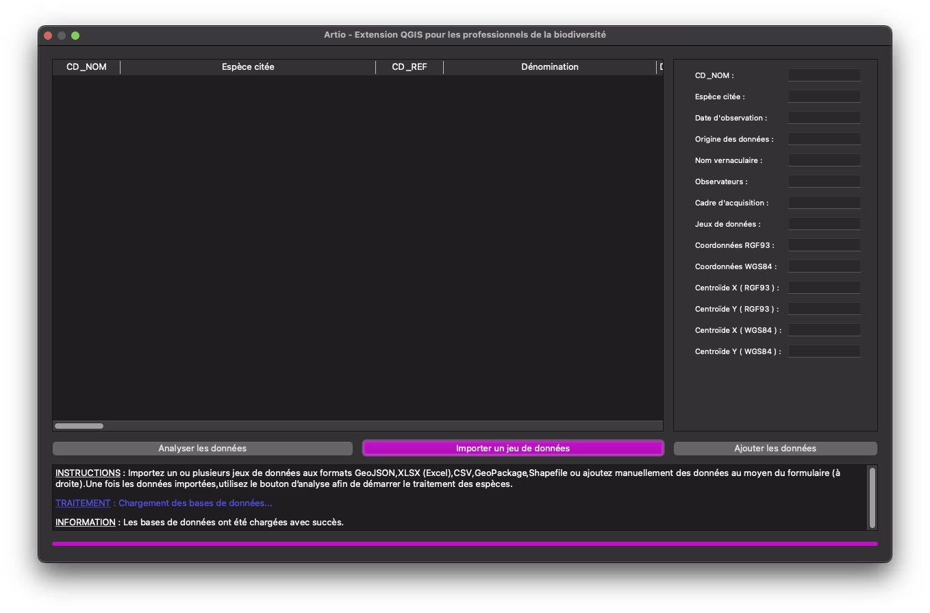
Screenshot of Artio's user interface
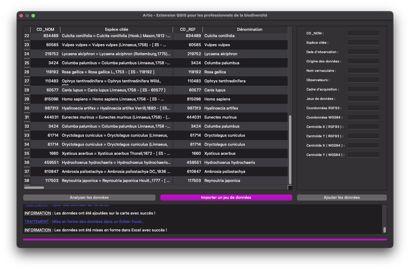
Biodiversity data analysis in Artio
Interested in a similar project?
Let's discuss your needs and discover how we can create a tailored solution for your organization.