PyTaxField
A QGIS extension for synchronizing naturalist data with GeoNature, developed by GEOCODE
Python
QGIS
PyQt
Client
Environmental consulting firm
Duration
? months
Category
Environment & GIS
Project Overview
PyTaxField is an extension for the QGIS software that allows easy synchronization of naturalist data with a GeoNature platform instance. It also performs various geographic interpolation operations to precisely associate records with a locality and altitude. This solution optimizes the management and reliability of ecological data, while facilitating the work of researchers and natural area managers thanks to an intuitive interface and advanced features.
Features
Synchronization of naturalist data with GeoNature
Intuitive user interface for data management
Geographic interpolation of records for precise localization
Automatic association of records with altitude and locality
Error management and data quality control
Technical Challenges
Integration of the GeoNature API for data synchronization
Management of geocoding errors and inconsistencies in naturalist data
Performance optimization for processing large amounts of data
Technologies Used
Python
QGIS
PyQt
Results Achieved
Improved accuracy of naturalist records
Facilitated access to data for researchers and natural area managers
Reduced data processing and synchronization time
Optimized monitoring and management of naturalist inventories
Visual Overview
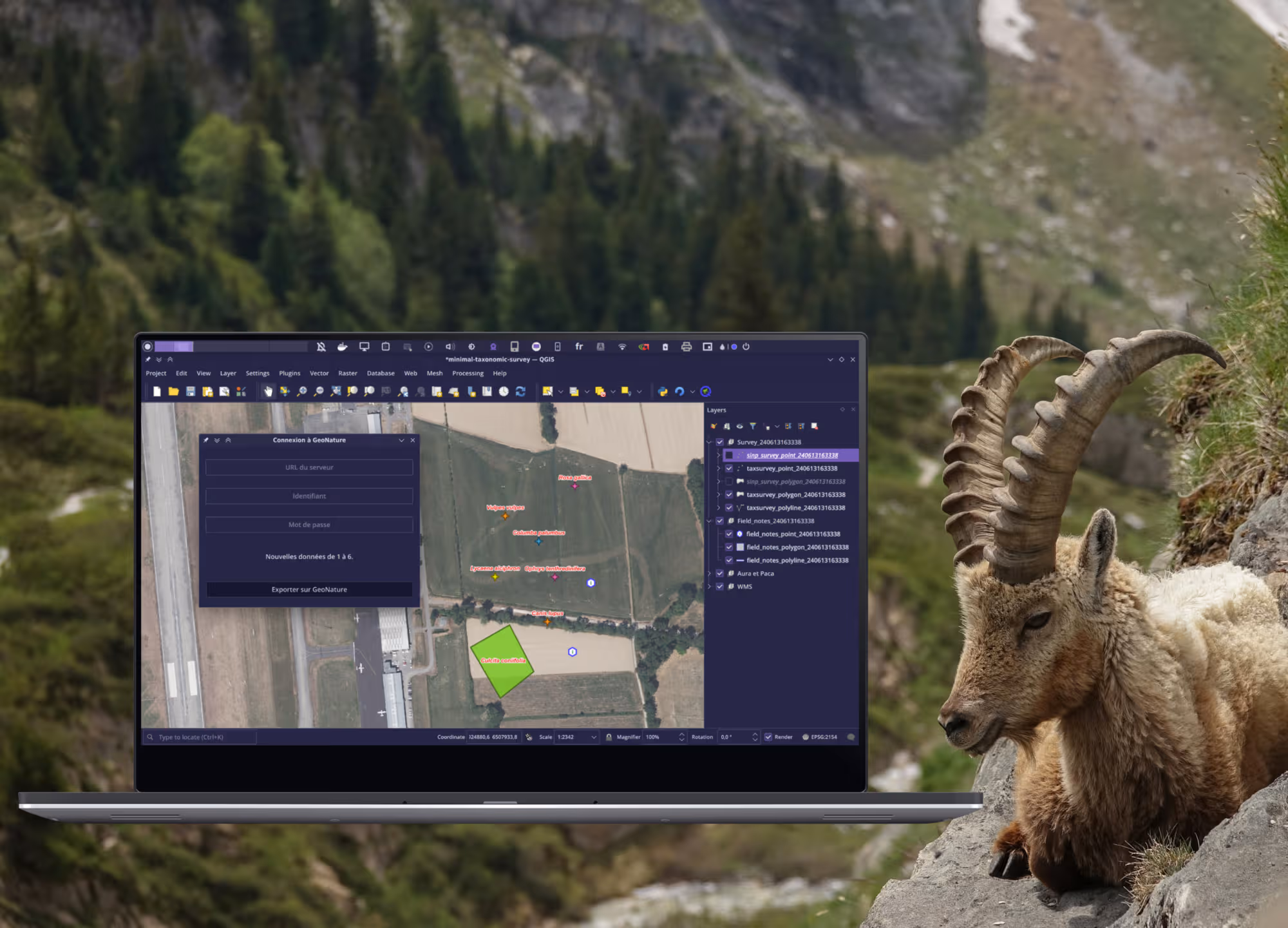
Screenshot of the PyTaxField user interface
Interested in a similar project?
Let's discuss your needs and discover how we can create a tailor-made solution for your organization