TaxField
TaxField field application for ecologists: management of taxonomic declarations, biodiversity data collection, and mobile species monitoring.
Python
QGIS
PyQt
Customer
Environmental consulting firm
Duration
? months
Category
Environment & GIS
Project Overview
TaxField is a mobile application developed to facilitate the management of taxonomic declarations in the field. It allows users to efficiently collect, organize, and send taxonomic data, while integrating mapping and spatial analysis features. Thanks to its intuitive interface and synchronization with GeoNature, TaxField optimizes species monitoring and biodiversity data quality, providing ecologists with a powerful tool for their field missions.
Functionalities
Taxonomic data collection
Mapping of observations
Integration with GeoNature
Technical Challenges
Integration of heterogeneous data
Automation of manual processes
Ensuring compliance with ecological standards
Technologies Used
Python
QGIS
PyQt
GeoNature API
Results Obtained
Reduction of data entry time in the field
Improvement of the accuracy of collected data
Facilitation of sending taxonomic declarations to databases
Visual Overview
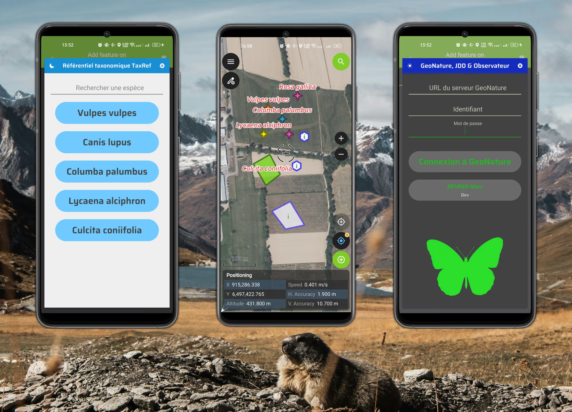
Screenshot of the TaxField user interface
Analysis of biodiversity data in TaxField
Interested in a similar project?
Let's discuss your needs and discover how we can create a custom solution for your organization