GIS Solutions for Hydrogeology and Water Resource Modeling
Specialized GIS solutions in hydrogeology for groundwater modeling, water resource management and spatial analysis of aquifers
Discover our servicesEcological Mapping
Creation of detailed maps of ecosystems and natural habitats for informed territory managementNatural habitat mapping
Ecosystem fragmentation analysis
Temporal change monitoring
Satellite data integration
Icon error...Wildlife and Flora Monitoring
Surveillance and analysis tools for species populations for biodiversity conservationGeolocated databases
Population modeling
Ecological corridors
Priority protection zones
Environmental Impact Analysis
Spatial assessment of human activities' impacts on ecosystems and biodiversityImpact modeling
Ecological sensitivity analysis
Compensatory measures
Automated reports
Environmental Dashboards
Interactive interfaces for real-time monitoring of biodiversity indicatorsBiodiversity indicators
Automatic alerts
Periodic reports
User-friendly interface
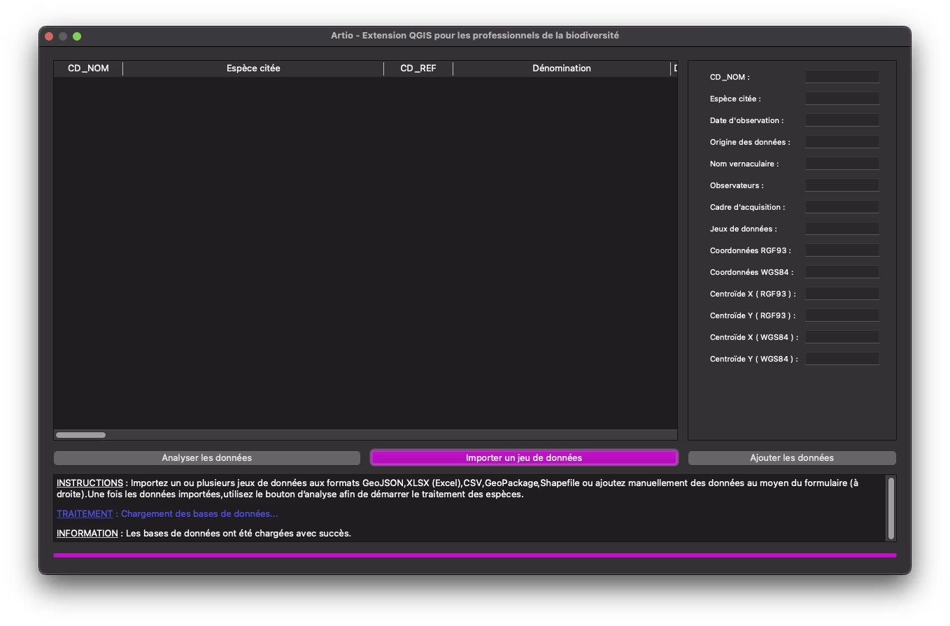
Artio
Generation of summary tables presenting species identified in a study framework with their associated statusesLearn more
Ready to model water resources?Contact us to discuss your hydrogeology needs and discover how our GIS solutions can support you